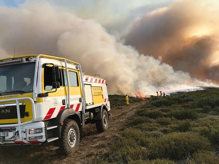
In the last 20 years, Portugal has been severely affected by large wildfires with dramatic consequences.
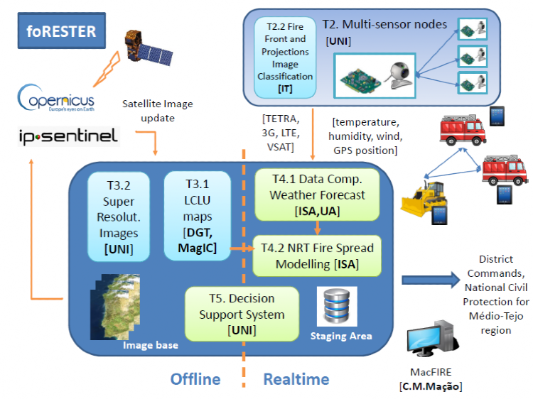
The main objective of this project is to combine the expertise of several institutions of the scientific community to provide sound and efficient tools capable of improving decision making during wildfires crisis to minimize its negative consequences.
WORKSHOP PROGRAM – MAÇÃO – 18.11.22 Data fusion of sensor networks and fire spread modelling for decision support in forest fire suppression
10h00 – Opening Dr. Vasco Estrela (Mayor of Mação Municipality)
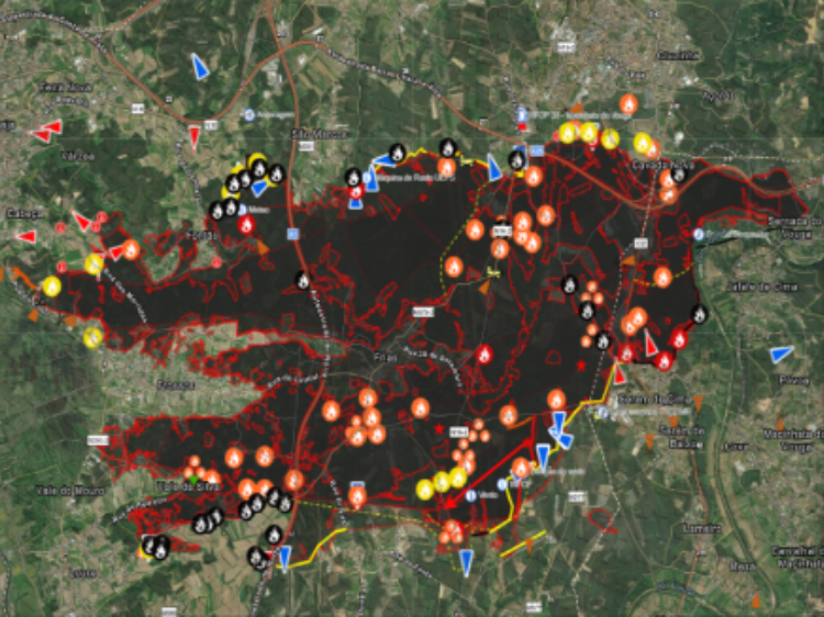
10h15 – Decision Support System MacFire Eng. António Louro (Vice-Mayor of Mação Municipality)
10h45 – Overview of project foRESTER Prof. Luís Bica Oliveira (PI, Associate Professor at FCT NOVA)
11h00 – Land Cover Mapping Prof. Mário Caetano (DGT Deputy Director-General)
11h30 – Coffee Break
12h00 – Fire Spread Simulations Dr. Ana Sá (Co-PI, Researcher at ISA)
12h30 – Discussion
13h00 – Lunch
15h00 – Decision Support System foRESTER Prof. André Mora (Professor at FCT NOVA)
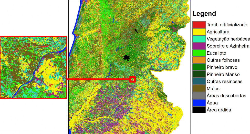
DGT (Direção-Geral do Território) is developing methods based on Artificial Intelligence
DGT (Direção-Geral do Território) is developing methods based on Artificial Intelligence to produce land cover maps and change detection based on intra- and inter-annual time series of Sentinel-2 satellite images and expert knowledge.
The maps produced differ from DGT’s current Land Use and Land cover map (COS) in that they represent land occupation in 13 classes in raster format (10-meter pixels), while COS also represents classes of land use in vector format with a minimum mapping unit of 1 ha.
In order to have a more precise and granular information from the field a low cost and power efficient, flexible, reconfigurable, multifunctional smart sensing system…